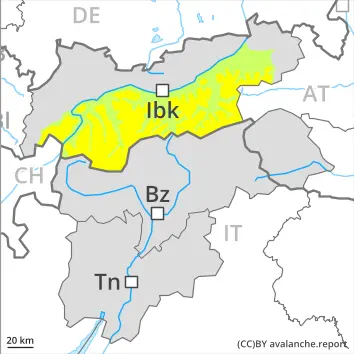
Info
Currently no avalanche forecast!
Dangerrating 2 – Moderate
Tendency: Danger avalanche increases
am 31. March 2026
am 31. March 2026
2200 m
Snowpack stability:
Poor
Frequency:
A Few
Avalanche size:
Large
2200 m
Snowpack stability:
Poor
Frequency:
A Few
Avalanche size:
Medium
Wind slabs and weakly bonded old snow represent the main danger.
Snowpack Structure Highlights
- Danger Patterns
- loose snow and wind
- cold on warm / warm on cold
The sometimes storm force wind has transported the fresh and old snow significantly. In some cases the various wind slabs have bonded still only poorly together.
The old snowpack will be weakly bonded in some places, especially on west, north and east facing slopes above approximately 2200 m, and on south facing slopes at elevated altitudes.
Weakly bonded old snow is to be evaluated with care and prudence. Over a wide area 20 to 30 cm of snow, and even more in some localities, will fall. The wind will be moderate over a wide area. Avalanche prone wind slabs will form.
In some places avalanches can be released in the old snowpack and reach large size in isolated cases, especially on west, north and east facing slopes above approximately 2200 m, and on south facing slopes at elevated altitudes. Whumpfing sounds and the formation of shooting cracks when stepping on the snowpack can indicate the danger. Remotely triggered avalanches are possible in isolated cases.
The fresh and older wind slabs can be released by a single winter sport participant in some cases above approximately 2200 m. Such avalanche prone locations are sometimes covered with new snow and are therefore difficult to recognise, caution is to be exercised in particular at the base of rock walls and behind abrupt changes in the terrain, as well as adjacent to ridgelines and in gullies and bowls. Mostly avalanches are medium-sized.